Safe Streets


Replica’s Safe Streets Planner enables public agencies to map existing conditions, analyze specific corridors, and generate their own High Conflict Corridor and Safety Action Plans.
Rather than investing in a one-off analysis or third-party report that will quickly become out of date as conditions on the ground change, Replica’s Safe Streets Planner updates each season with the most recent data.
Want Access?
Thank you! A team member will reach out shortly!
Oops! Something went wrong while submitting the form.
In Action
- Safe Streets Planner is designed to make it easier and quicker for understaffed and overworked agencies to get the answers they need related to Bike & Ped infrastructure, Vision Zero initiatives, and all safe streets planning activities.
- By combining Replica’s detailed multimodal data and driving event data from Michelin Mobility Intelligence, the Safe Street Planner app offers market-leading insight in an easy-to-use interface.
- Incorporating driving event data like speeding, hard-braking, and distracted driving rather than crash data, the Safe Streets Planner enables agencies to proactively identify and address high-risk corridors before crashes occur.

Use Cases
Replica has helped more than 150 customers across the United States make informed decisions to create stronger, more resilient, and more equitable places.
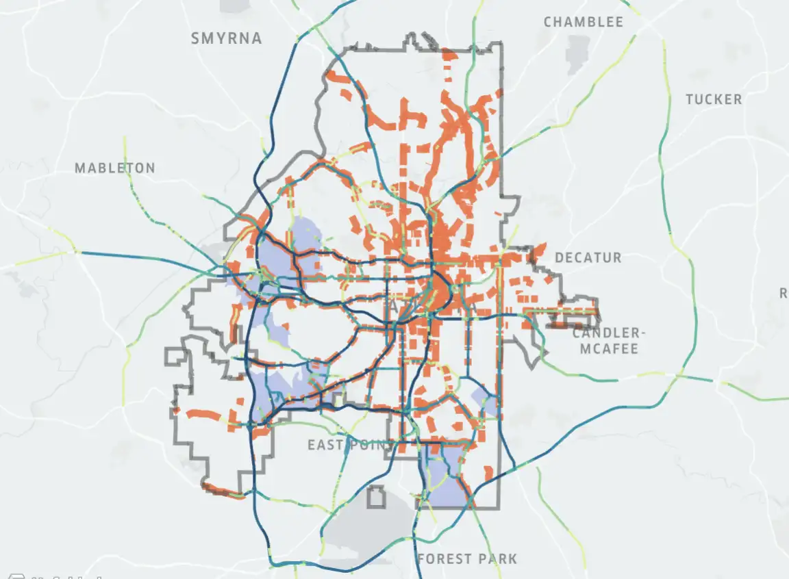
Vision Zero Atlanta
Marginalized communities are at risk on streets that extend beyond their home communities. Replica data allows us to match trips of Communities of Concern residents to cities' High Injury Networks creating a more holistic approach to safety and equity concerns. Visit our blog to learn more.
NYC Most Dangerous Intersections
Replica data is used to visualize all of New York City’s most dangerous intersections and what intersections to prioritize for safety improvements. Visit our blog to learn more.
- Created a new dataset and an interactive map to help policymakers and the public understand more about the intersections where incidents occur.
- Shows where senior citizens on foot or bike make up higher shares of all trips taken at intersections
- Replica gives you the right tools to communicate your data — and decisions based on it — with policymakers and the public.


Alta’s Active Transportation Project Prioritization
Replica’s mobility and land use data was used to help Alta’s clients understand existing conditions and identify next steps for investing effectively in active transportation.
- As part of implementing MnDOT’s Statewide Pedestrian System Plan, Alta is analyzing about 2,000 half-mile-wide areas across Minnesota.
- Replica data combined with a latent demand analysis previously developed by the Greater Nashville Regional Council illustrated the potential demand for new bike lanes and shared-use paths in Sumner County TN.
- For the Fargo-Moorhead Metropolitan Area in North Dakota and Minnesota, Alta used Replica Data to produce a list of priority investment areas for cycling and walking.
Crash Data Augmentation
Replica’s data can also be used to normalize severe injury and fatality crash data to go beyond where crashes are happening, and determine where road users are most at risk. Paired with neighborhoods where vulnerable populations reside, this quick analysis can augment a traditional high injury network street prioritization by layering in vulnerable population volumes. For an example of such an investigation, please refer to Replica’s SS4A Webinar and blog post featuring the city of Atlanta.

Tune in as we:
- Demo the Safe Streets Planning Application
- Learn about Safety success stories in Hoboken in a discussion with Gregory Francese
- Discuss best practices from Cityfi, featuring Karina Ricks
- Highlight the best use cases for using big data in safety planning
3610 W. 95th Street
Leawood, KS. 66206
Copyright © ReplicaHQ
All Rights Reserved
All Rights Reserved