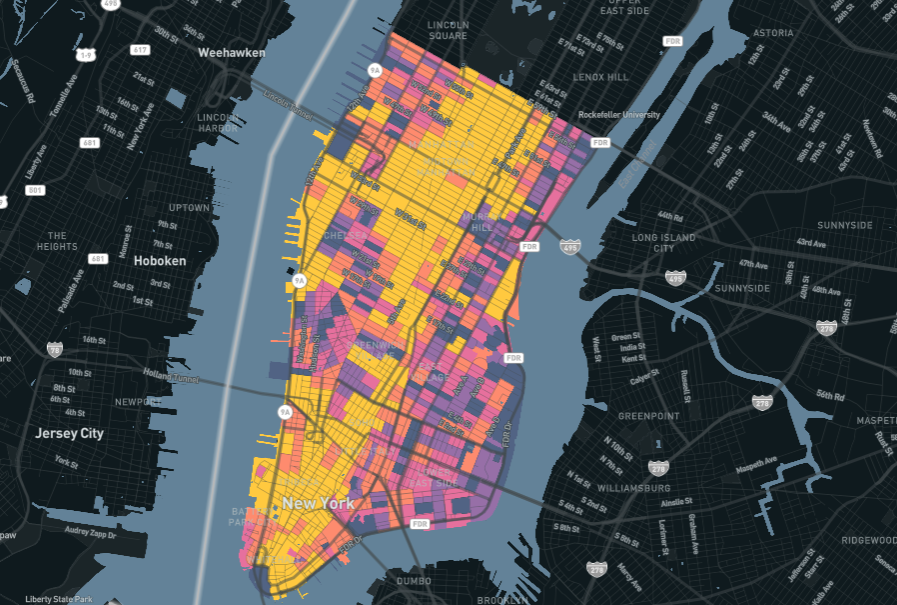
This week, Replica released our newest Places Megaregion: Cal-Nev. This region includes all of California and Nevada, and combines what was previously two smaller regions (NorCal and SoCal) into a single model covering more than 40 million people.
With this new release, customers can now study highly trafficked long-range corridors that connect, for example, San Francisco to Los Angeles or Los Angeles to Las Vegas. New features also make it possible to filter people by whether or not they work from home, and the ability to filter trips by the land use of origin or destination.
Our team of solutions architects have already explored the ability to see long distance freight travel along I-15, here. If this or a similar use case is a high priority for you, please reach out to schedule a demonstration.
This release marks the kickoff of our first Places Megaregion refresh. Over the next few months, we’ll be releasing Spring 2021 data and updated Fall 2019 data for the entire country.

Here’s what you can expect with these updates:
- Spring 2021 Data. Our newest releases will be the first time detailed, disaggregate, activity-based model data exists for the Covid era.
- Work From Home Data. New releases (for both 2021 and 2019) include work from home as an activity type, and enable users to filter people by whether or not they work from home.
- Land Use Data. New releases (for both 2021 and 2019) match each trip’s origin and destination to an associated land use, enabling users to study differences in travel behavior based on land use patterns.
- 10 Regions. We’re publishing the whole country in 10 regions, down from 14, ensuring that no state is split in two and users have even greater ability to study long distance trips.
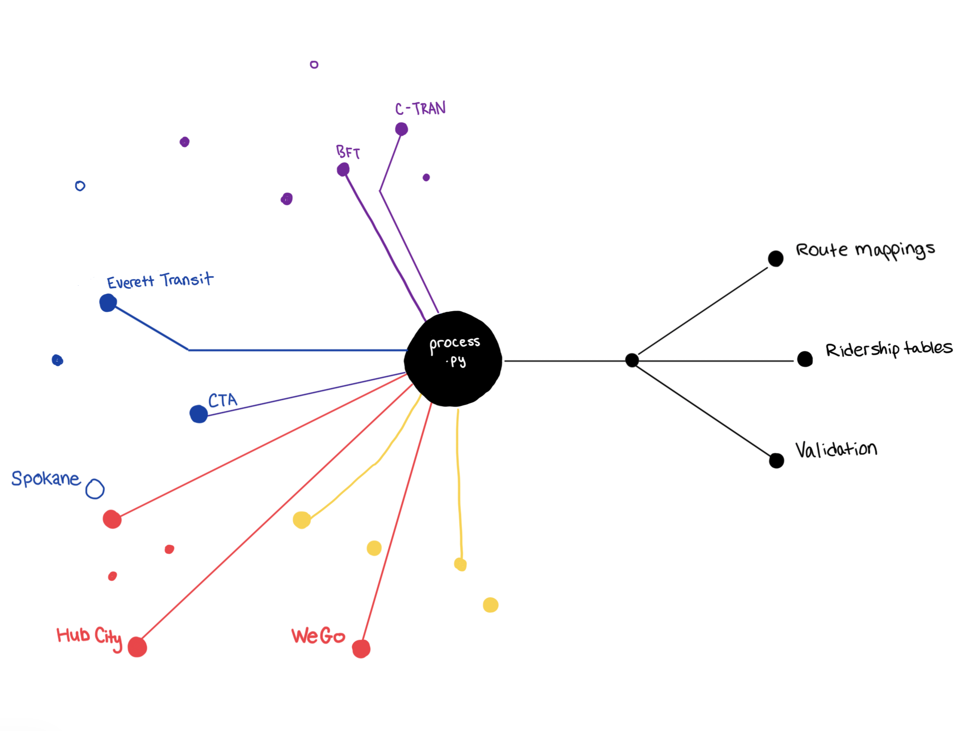
- Complete Road Network Coverage. Each model includes auto counts for every road in the network, from interstates to arterials to local roads.
- Extensive Transit Coverage. Nationwide, Replica incorporates transit data from over 300 agencies and 11,000 individual routes, ensuring our customers have a better multi-modal picture.
- Real-time Comparisons. These new releases, and an updated Trends pipeline that will go live this month, will make it easier to compare data between Places and Trends. You’ll be able to conduct detailed analyses of Fall 2019 or Spring 2021 in Places, and then check Trends to see what that activity looks like today.
- Custom Geos. Interested in custom zones of analysis? Upload these files and we’ll publish them to your account so you can create the cut of data you need most.
- No Lost Work. Don’t worry. Whether it’s a custom geo or a saved workbook, if you have work saved in the Replica platform, we’ll automatically move it over to new regions and seasons so nothing needs to be recreated from scratch.
We know how important it is to our customers to have high-quality, privacy-protecting, impartial, and recent data that they can trust. We hope you’re as excited to have this data as we are to roll it out.


.jpg)