Cities across the country are reimagining how people move, placing greater emphasis on walking, biking, and other forms of active transportation. By combining thoughtful planning with advanced data analysis, communities can design safer, more connected streets that encourage healthier, more sustainable ways to get around. Cupertino, California is collaborating with Alta, a leading active transportation firm, to develop an Active Transportation Plan (ATP) that leverages cutting-edge data analysis, including Replica data, to create a more connected and accessible community for walkers and cyclists.
The city's previous bike plan, adopted in 2016, saw great success in project completion. However, as David Stillman, Transportation Manager for the City of Cupertino, explains, "It's been several years, and things changed over the course of that time. It was time for a new look at the community's needs." The city had also developed a separate pedestrian plan in 2018, leading to some confusion regarding project prioritization. The new ATP aims to unify these efforts into a single, comprehensive plan, ensuring continued eligibility for grant funding and a fresh perspective on community needs.
Community Insights Meet Data Innovation
Cupertino community members have expressed a desire for the city to embrace modern methods for transportation management and planning. Matthew Schroeder, Senior Transportation Planner for Cupertino, notes that Alta's proposal clearly demonstrated their ability to "bring some pretty innovative techniques to project recommendations." This commitment to data-driven recommendations, coupled with robust community outreach, is a cornerstone of the plan's development.
Community outreach has been a constant throughout the planning process, from identifying needs in the initial phase to gathering feedback on proposed improvements. Methods have included city channel postings, pop-up events at festivals, senior fairs, and engagement with safe routes to school programs. Alta further facilitated this by developing a mobile-friendly website, making it easy for residents to provide comments and map their input.
Christopher Kidd, a Project Manager at Alta, highlights how public engagement data is integrated with their analysis: "We really wanted to be able to use the public engagement data that we got to help kind of validate or show the truth of some of the findings that we got through our analysis." This blend of lived experience and data reinforces the findings and allows local knowledge to supplement findings where analysis might not perfectly capture the nuances of roadway experience.
Unveiling Latent Demand with AltaFlow Maps and Replica Data
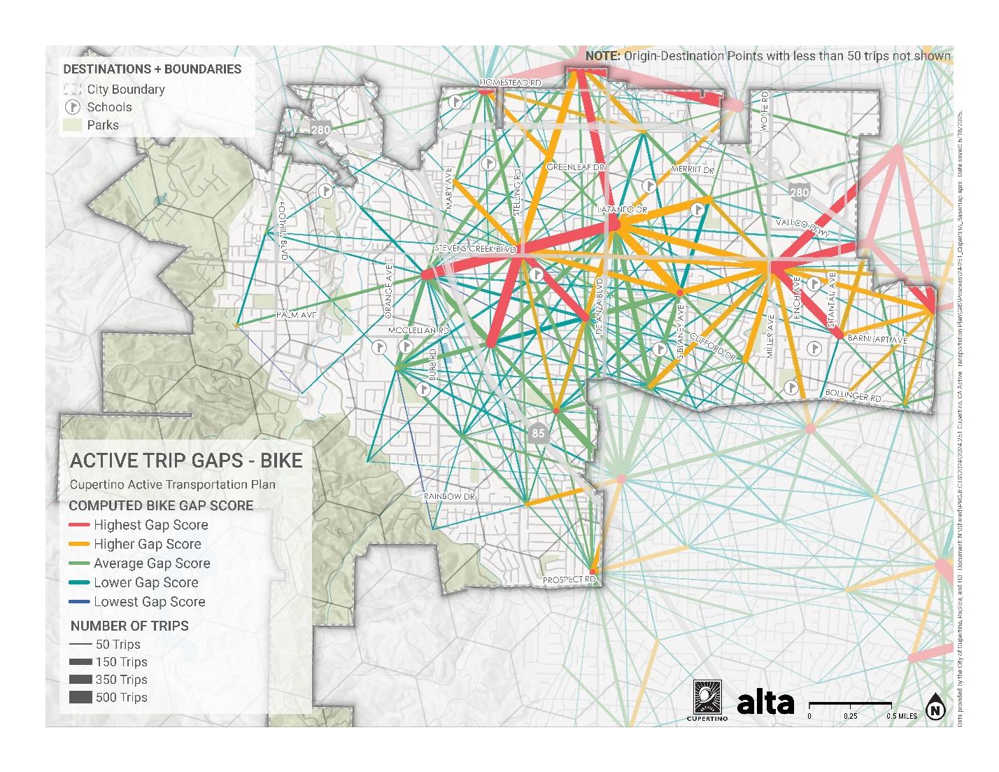
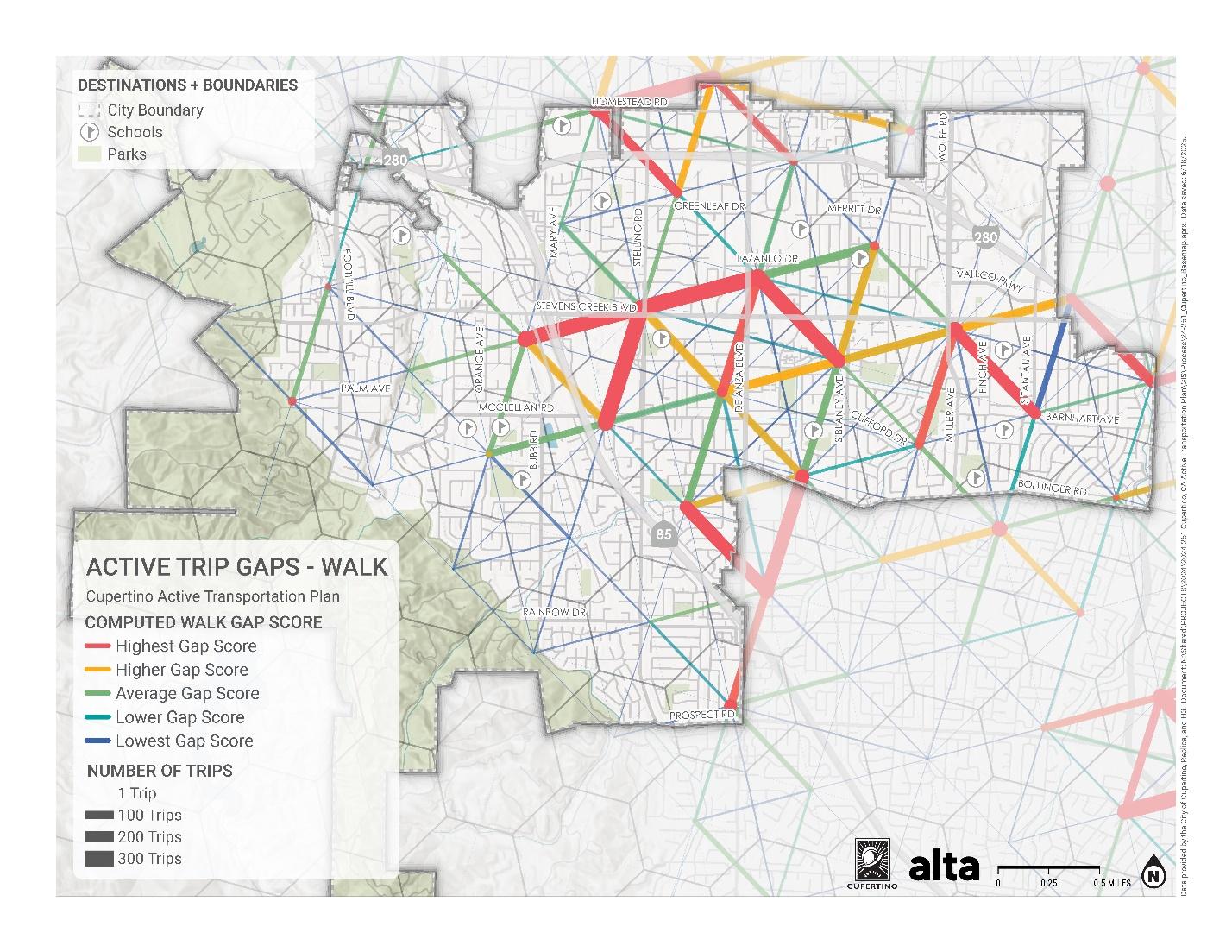
One of the innovative aspects of this project is Alta's use of Replica data in AltaFlow maps, a methodology developed by Alta's Civic Analytics Leader, David Wasserman. These maps showcase the flows of short driving trips, particularly those that could potentially be replaced by walking or biking.
For Cupertino, this has been a revelation. As Matthew Schroeder explains, "My first reaction was just that this is going to be incredibly helpful in visually communicating the potential for just what future investment could do." He points to a planned Class IV bike lane project on Stevens Creek Boulevard, an area identified by the analysis as having many short trips. According to Matthew, for future projects like the Stevens Creek Boulevard project, "being able to show that there's potential and trips that are currently occurring that could be accomplished by biking is going to be useful when we go and move forward with project development."
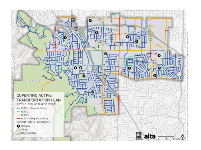
David Wasserman elaborates on the sophistication of this analysis, which combines short trip potential with the "experience of on the network," a concept rooted in level of traffic stress (LTS) analysis. LTS considers factors like the number of lanes, speed limits, and available infrastructure (like sidewalks and bike lanes) to assess how comfortable and safe a road feels for active transportation.
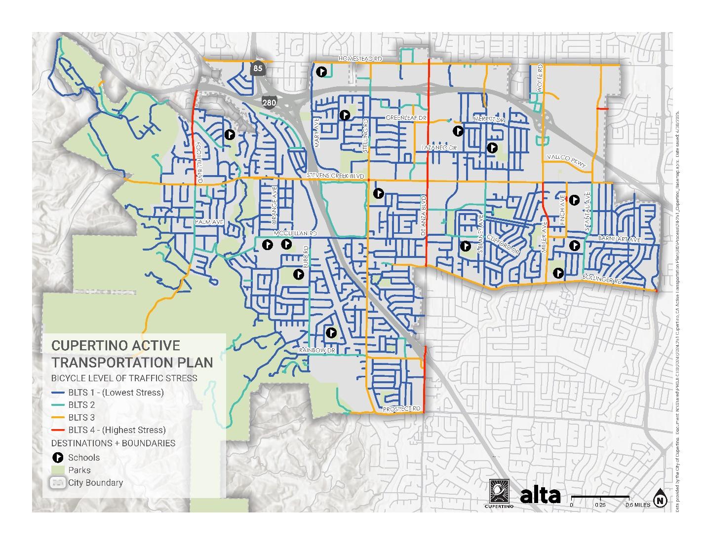
By creating a gap score that represents the short trips that would have a stressful path along the network relative to their actual proximity, Alta can pinpoint areas with high potential for active transportation but significant barriers due to stress. These hard-to-reach areas with lots of short trips become prime candidates for infrastructure improvements.
From Data to Decisions: Justification and Prioritization
This innovative analysis serves a dual purpose: justifying certain recommendations and aiding in prioritization. Christopher Kidd explains that it provides "some analysis that can help...balance out some of the more traditional analysis that we see out there around things like...level of service and... congestion delay." While it's still early in the process, the Cupertino team is optimistic about the impact. The highly visual nature of the gap score maps, which simplify complex data into easily digestible geographical distributions, will be crucial in this communication.
This partnership between Cupertino and Alta, powered by Replica data, exemplifies how data-driven insights, combined with robust community engagement, can lead to more effective and impactful active transportation planning. As Cupertino continues to develop its ATP, the lessons learned from this innovative approach will undoubtedly serve as a model for other cities seeking to create more vibrant, connected, and actively mobile communities.

