The U.S. Department of Transportation’s Safe Streets for All grant program aims to help local governments reverse the alarming increase in deaths and injuries on America’s roads.
With $5 billion in grants available over five years, the initiative will provide funding to local governments to improve conditions for pedestrians, cyclists, and drivers alike — in an equitable way.
The initiative emphasizes equity and innovation, prompting public agencies to carefully consider the data they need in order to develop and implement new safety action plans.
Traffic and crash data will play an important part, but USDOT’s notice of funding opportunity acknowledges that those aren’t enough on their own. To invest equitably in safer streets, it’s essential to leverage data that helps you understand who is at risk, where they face that risk, and how they will benefit from new investments.
A Fuller View of Transportation Equity
Transportation equity is about where people go, not just where they live.
With nuanced and granular data about people and mobility activity, it’s possible to assess how a proposed project will serve people across demographic and socioeconomic groups where they actually travel.
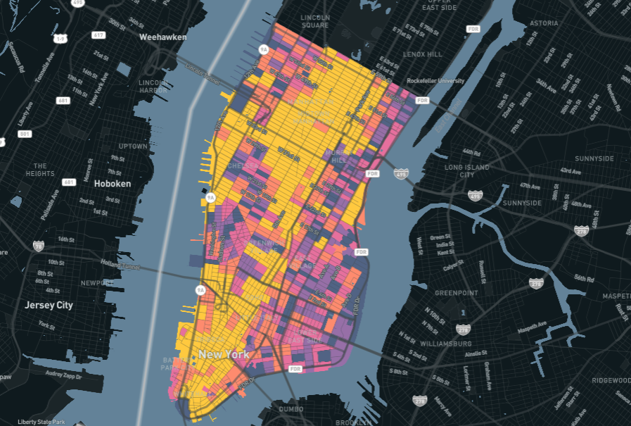
To demonstrate what this looks like, we looked at mobility activity of the Communities of Concern as defined in Atlanta’s Vision Zero Action Plan.

According to Replica data, the Communities of Concern represent high-minority and low-income communities in Atlanta. More than 88% of the residents in these geographies are Black, and more than 60% of the households make less than $50,000 per year.
The map on the left shows the communities and their population totals. The middle map shows what neighborhoods those residents travel to around the city, and the right map visualizes the corridors where those residents travel most frequently.
By layering that road volume map with a map of Atlanta’s high injury network, patterns begin to emerge that show where safety improvements can also have the greatest impact on communities of concern, and on the city overall.
The granular data behind this analysis can reveal much more, without compromising privacy. Similar analyses are possible for walking, cycling, or transit activity specifically, or based on travelers’ characteristics like age, income, or number of cars at home. (Earlier this year, we demonstrated how Replica’s modeled data can inform new ways to identify and prioritize dangerous intersections.)
And with flexible data tools that allow the use of custom geographies, it’s easy to analyze this activity within a city’s local jurisdictions, Justice40-defined disadvantaged communities, or Vision Zero priority areas.
A Chance to Innovate
Safe Streets for All is an important nationwide effort with high stakes.
Safer streets can save lives, improve quality of life and public health, address inequities in the built environment, and have far-reaching economic and environmental impacts on communities and the cities around them.
USDOT has emphasized this initiative as an opportunity for cities and MPOs to embrace new, innovative approaches to delivering safer streets in equitable and impactful ways.
We built Replica with the knowledge that mobility doesn’t operate in a vacuum. It’s deeply interconnected with other elements across the built environment, including land use, economic activity, people, and communities.
To do impactful work, transportation professionals need data that provides holistic insights across these categories so they can keep people safe — wherever they travel.


.jpg)